PERROC (VS)
Landslide (sagging), active rock glacier
Elevation: 2100-2750m - Massif: Valais Alps (Arolla) - Commune: Evolène (VS)
The displacement of the landslide (sagging) of Perroc, located on the western foothill of the Blanche de Perroc above 2700 meters has been measured on a regular basis since 2005. Velocities of a magnitude of 10 to 15 centimeters per year are observed in the middle section of the movement zone. The seasonal velocity regime is typical for a landslide, which is reactivated by the percolation of the snowmelt water (peak in early summer). About 500 m southwards, a tiny active rock glacier is also surveyed since 2016. The seasonal regime is here typical for permafrost creep (peak in autumn).
-
Measurements and observations
Geodetic (GNSS)
-
Figures
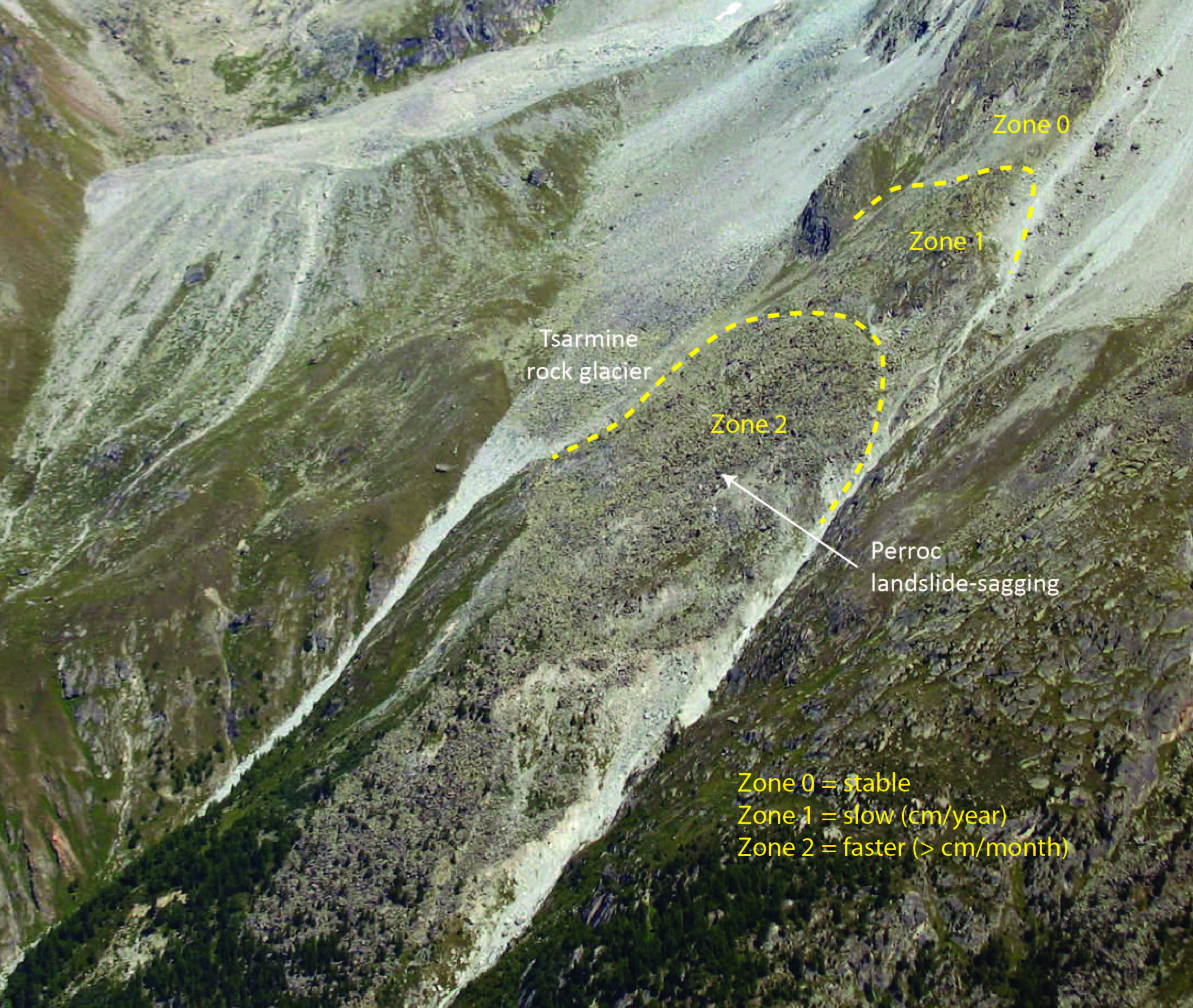
Main parts of the Perroc landslide/sagging. The lower limit of the moving zone is not clearly defined (forested area).
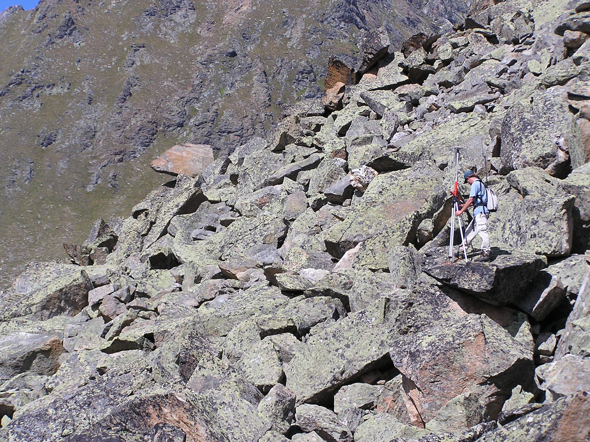
GNSS measurements on the Perroc landslide.
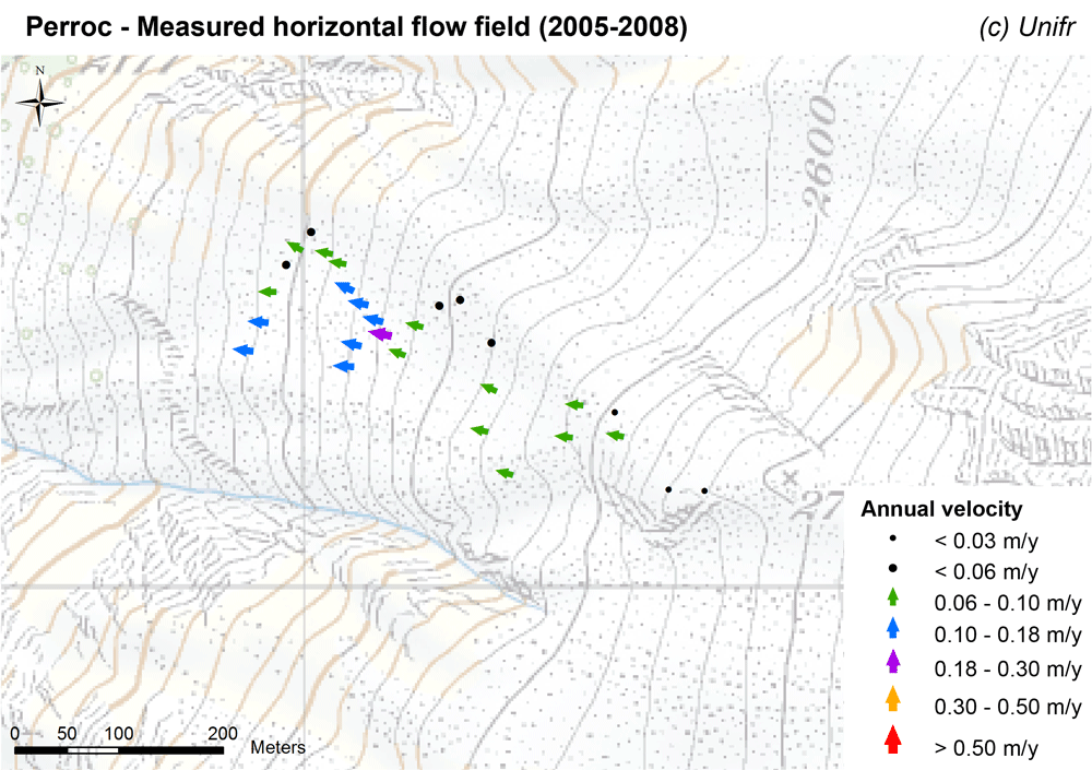
Measured horizontal flow field (mean annual velocity) on the Perroc landslide.
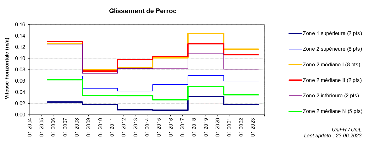
Annual horizontal surface velocity. Mean of a set of points selected in the most active part of the Perroc landslide.
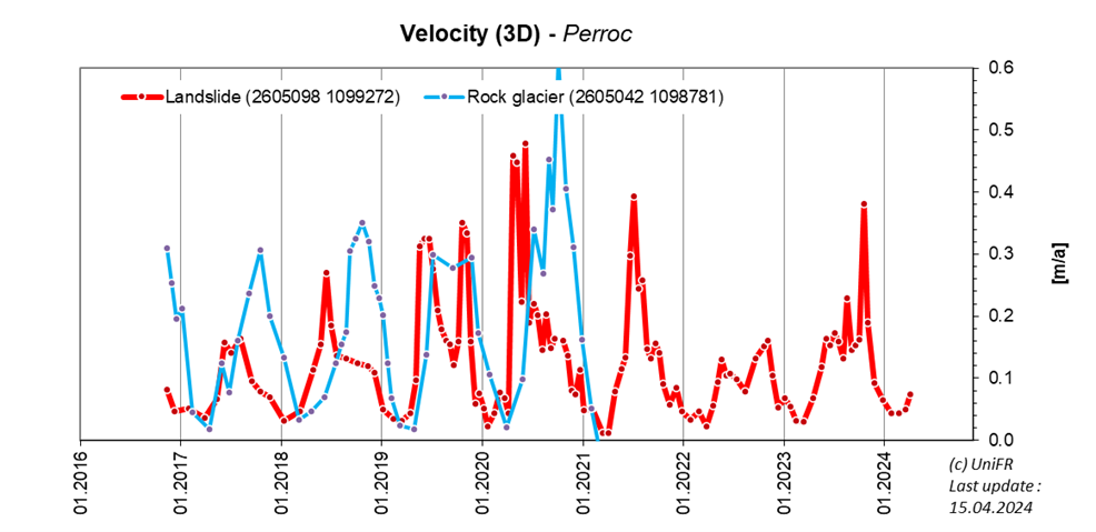
3D surface velocity derived from permanent GNSS stations on both the Perroc landslide and rock glacier.
-
Collaboration
University of Lausanne, Institute of Earth Surface Dynamics (C. Lambiel)
Commune of Evolène
Service des forêts, des cours d'eau et du paysage du Canton du Valais
Geosat SA
-
Publications
Barboux, C., Delaloye R. and Lambiel, C. (2014). Inventorying slope movements in an Alpine environment using DInSAR. Earth Surface Processes and Landforms, 39/15, p2087-2099. DOI: 10.1002/esp.3603