ARPILLE (VS)
Rock glacier / landslide
Elevation: 2340-2700m - Massif: Sanetsch-Wildhorn - Commune: Savièse - VS
The superficial deposits covering the northern slope of the Arpille crest show characteristics of both rock glacier and landslide morphologies. Electrical resistivity measurements have shown that permafrost might be present at depth. A network of GPS measurement points has been set up on this complex landform in 2011 in order to determine its displacement velocities and to render the deformation mechanisms involved more precisely.
-
Measurements and observations
Thermal (ground surface temperature : GST)
Geodetic (GNSS) -
Figures
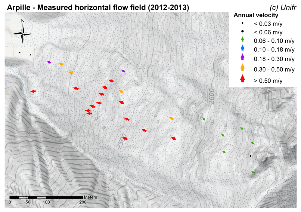
Measured horizontal flow field (mean annual velocity).
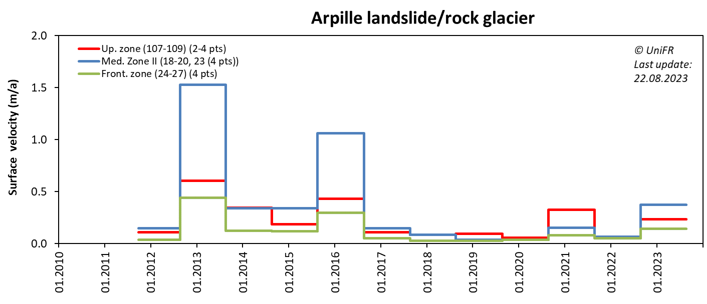
Annual horizontal surface velocity. Mean of a set of points selected in several sections of the moving landform.
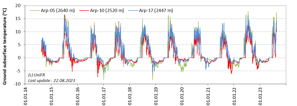
Daily ground surface temperature (GST) at three locations along the moving landform.
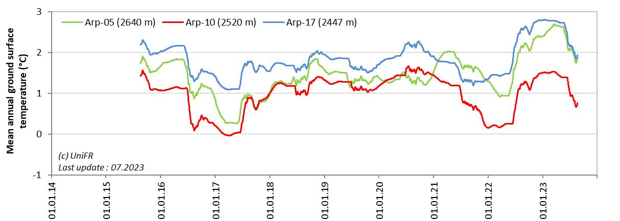
Mean annual ground surface temperature (MAGST) at three locations along the moving landform.
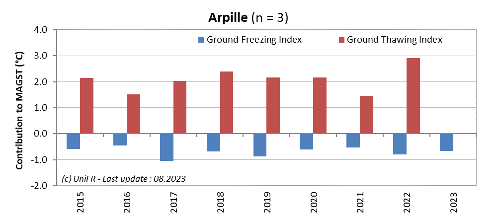
Contribution of the annual Ground Freezing (sum of all daily mean values < 0°C) and Ground Thawing (>0°C) Indexes to the mean annual ground surface temperature (MAGST) on a set of selected locations (n) on the site. Or : how cold was the winter and how warm was the summer at the surface of the ground ?
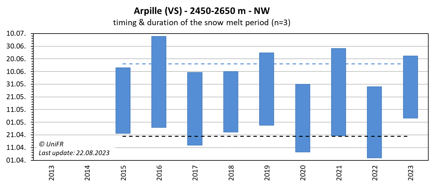
Annual dates of the start and end of the snowmelt period (zero curtain phase). Mean of n sensors placed on permafrost terrain. The dotted lines show the mean dates since the beginning of the time series.
-
Collaboration
Department of Geography, Ghent University (Belgium), H. Hendrickx
-
Publications
Russil, J. (2000). The application of DC resistivity tomography to permafrost prospecting and characterisation in the Swiss Alps. Diss. project, Dept. Earth Sciences, Univ. Cardiff, Wales.