JEGI (VS)
Active rock glacier, deep-seated landslide (sagging)
Altitude: 2450-2800 m - Massif: Valais Alps (Fletschhorn) - Commune : Saas-Balen (VS)
Jegi rock glacier consists of a rooting zone (2700-2800 m) and a body down to an upper front (2550 m) overriding a 150 m long second tongue. The rock glacier is prone to destabilization processes since earlier than the 1950s. Currently the upper body – between 2670 und 2550 m - has to be considered as destabilized : displacement rates are large (in particular, the upper front has moved more than 10 m/y since 2015) and many scarps and crevasses are opening. The rock glacier is located on a larger deep-seated landslide developing mainly to the south of it. DGNSS points in a large network covering the rock glacier and its surrounding area (landslide) are measured regularly since 2009.
-
Measurements and observations
Thermal (ground surface temperature: GST)
Geodetic (GNSS, incl. permanent station) -
Figures
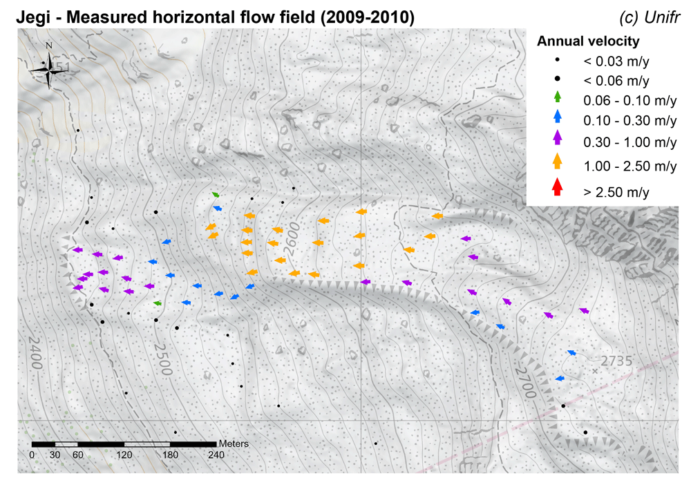
Measured horizontal flow field (mean annual velocity).
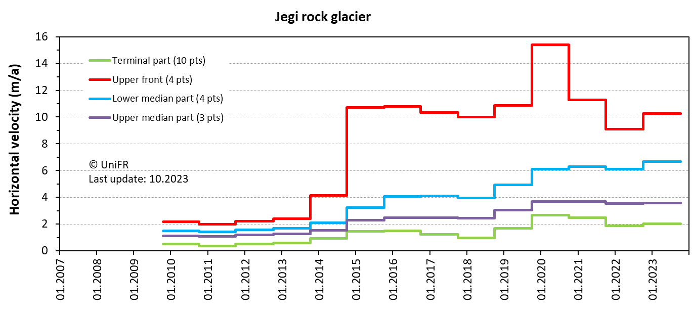
Annual horizontal surface velocity. Mean of a set of points in the selected parts of the rock glacier.
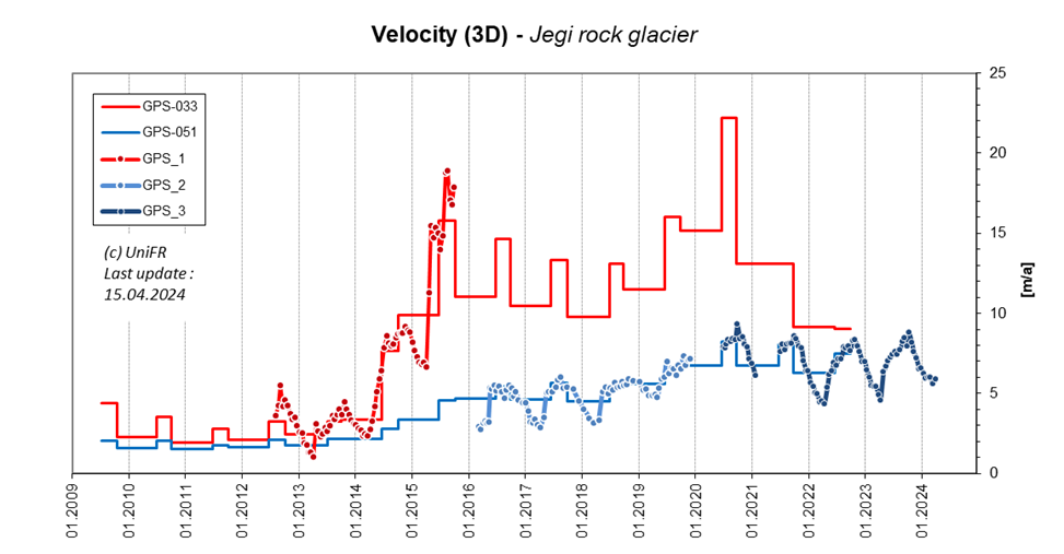
3D surface velocity derived from permanent GPS.
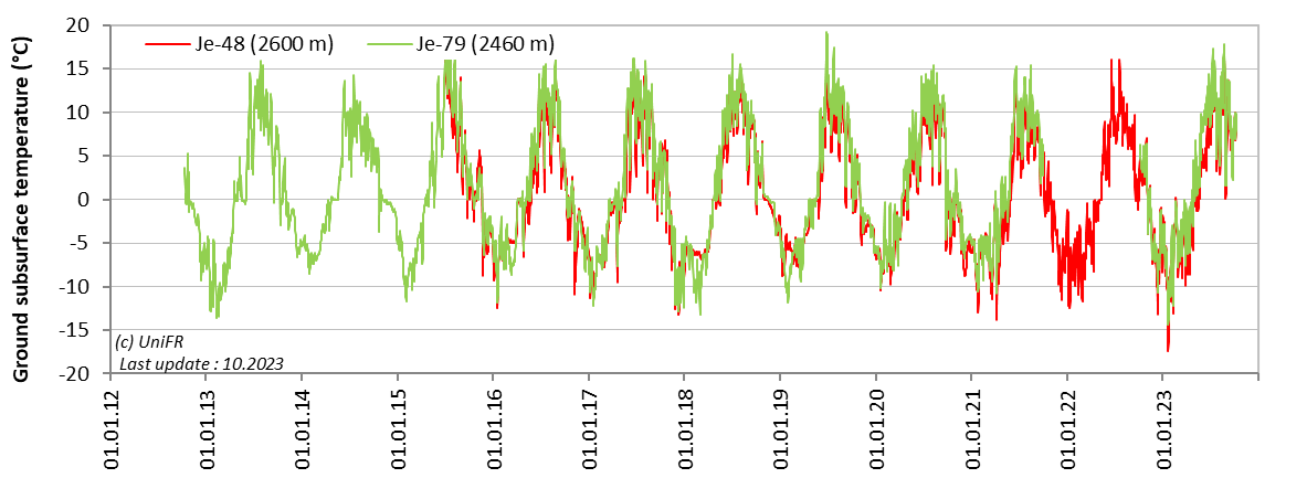
Daily ground surface temperature (GST) in selected measurement locations on the rock glacier.
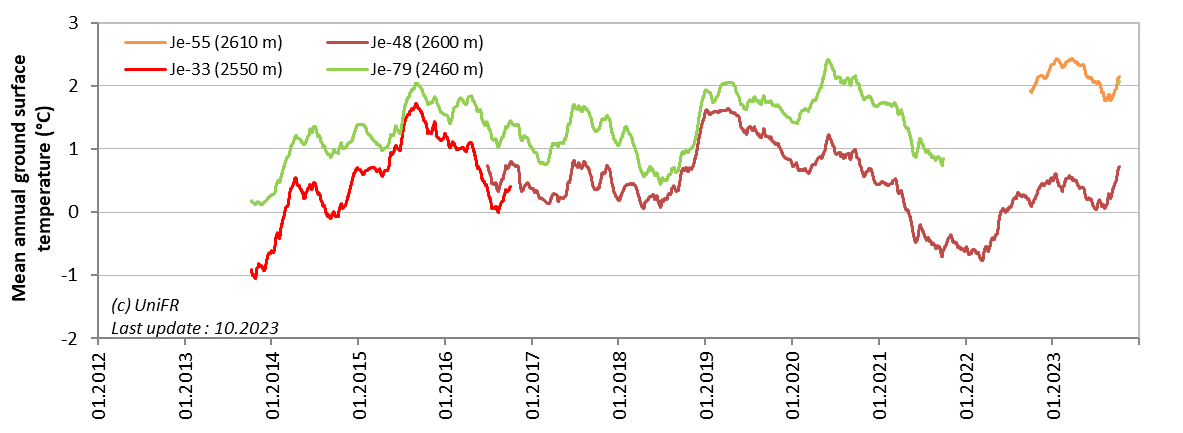
Mean annual ground surface temperature (MAGST) in selected measurement locations on the rock glacier.
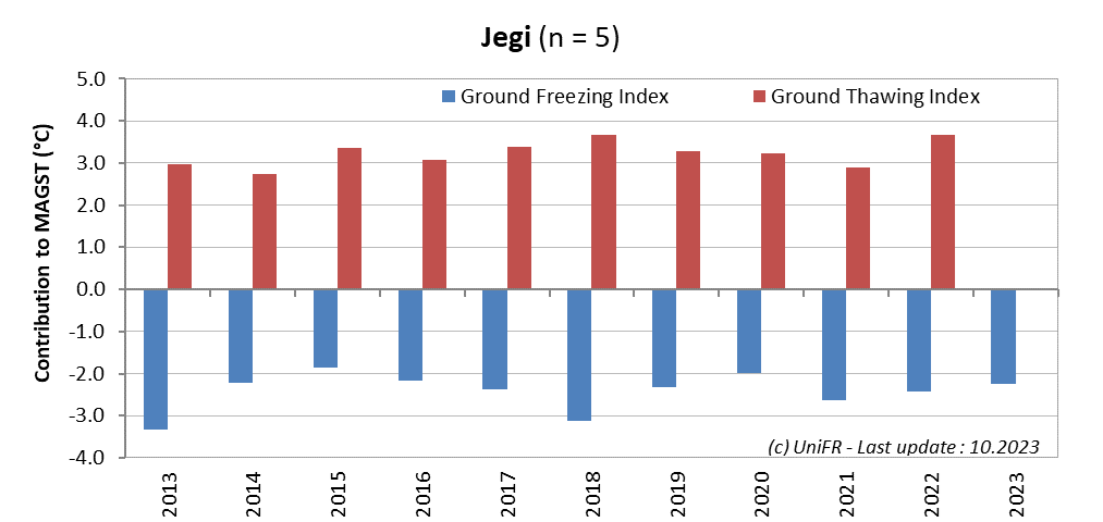
Contribution of the Ground Freezing and Ground Thawing Indexes to the mean annual ground surface temperature (MAGST) on a set of selected locations (n) on the rock glacier. Or : how cold was the winter and how warm was the summer at the surface of the rock glacier ?
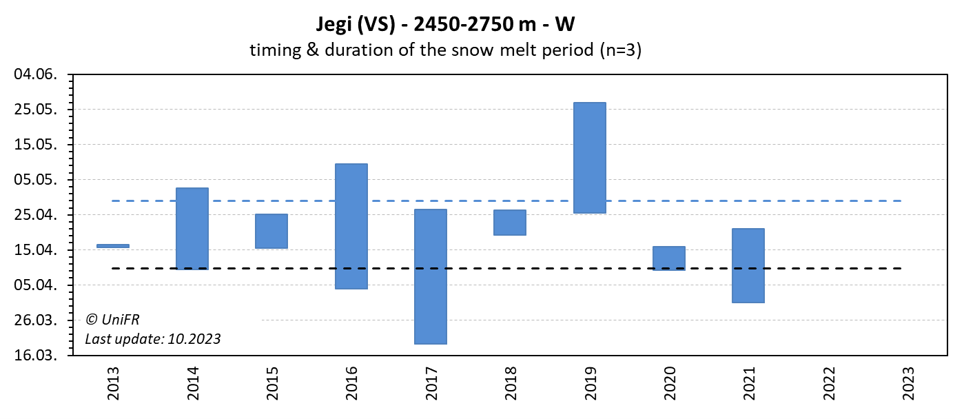
Mean annual dates of the start and end of the snowmelt period (zero curtain phase). Mean of n sensors localized on permafrost terrain.
-
Collaboration
WSL Mountain Hydrology and Mass Movements (C. Graf, Y. Bühler)
Geosat SA
Further measurements are undertaken by the Federal Office for the Environment und ETH Zurich.
-
Publications
Ghirlanda, A., Braillard, L., Delaloye, R., Kummert, M. and Staub, B. (2016) The complex pluri-decennial and multiphasic destabilization of the Jegi rock glacier (western Swiss Alps): historical development and ongoing crisis. In: Günther, F. and Morgenstern, A. (Eds.) (2016): XI. International Conference On Permafrost – Book of Abstracts, 20 – 24 June 2016, Potsdam, Germany. Bibliothek Wissenschaftspark Albert Einstein. 36-38. (pdf)
Barboux, C., Delaloye R. and Lambiel, C. (2014). Inventorying slope movements in an Alpine environment using DInSAR. Earth Surface Processes and Landforms, 39/15, p2087-2099. DOI: 10.1002/esp.3603