BLAUBERG (UR)
Rock glacier
Elevation: 2640-2680m - Massif: Uri Alps (Furka) - Commune: Realp (UR)
The rock glacier as part of the historical proglacial margin of local glacieret (snowfield) is located southeast of Blauberg. During the Little Ice Age, the rock glacier was overriden by a glacier, which brought a push moraine into being, i.e. a large mass of frozen sediments, which was pushed, dragged and deformed by the progression of a glacier. Today the glacier has disappeared. The tongue of the rock glacier is almost stable (no movement), whereas the push moraine, whose sub stratum is still frozen, is mainly creeping back towards the depression left by the former glacier at a velocity of up to ten centimeters per year.
-
Measurements and observations
Geodetic (GNSS)
Thermal (ground surface temperature : GST) -
Figures

Measured horizontal flow field (mean annual velocity).
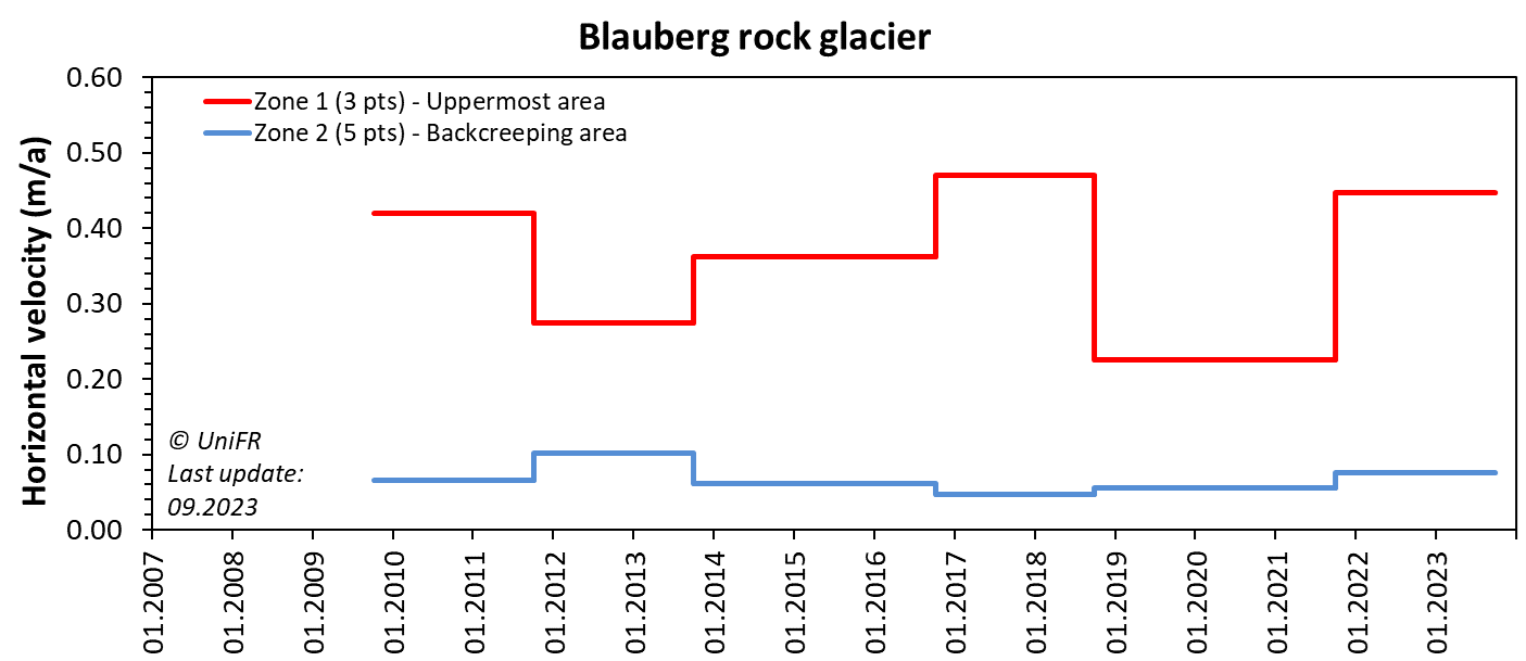
Annual horizontal surface velocity in several sections of the rock glacier. Mean of selected sets of points.
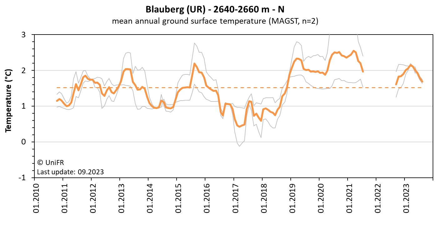
Mean annual ground surface temperature. The orange curve represents the mean temperature of the n sensors installed on the site (grey curves). The orange dotted line is the mean temperature observed since the beginning of the time series.
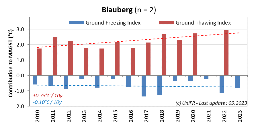
Contribution of the annual Ground Freezing (sum of all daily mean values < 0°C) and Ground Thawing (>0°C) Indexes to the mean annual ground surface temperature (MAGST) on a set of selected locations (n) on the rock glacier. Or : how cold was the winter and how warm was the summer at the surface of the rock glacier ?
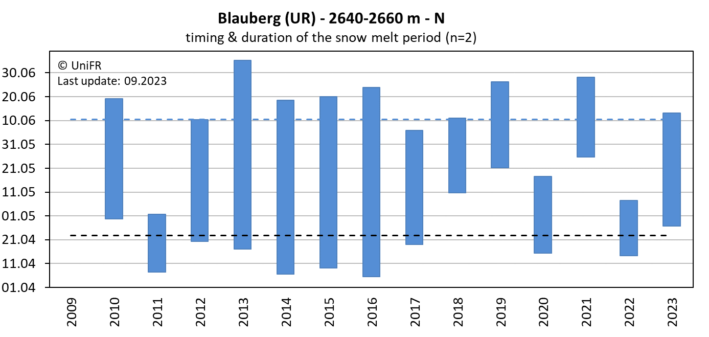
Mean annual dates of the start and end of the snowmelt period (zero curtain phase) on a set of selected locations (n) on the rock glacier. The dotted lines show the mean dates since the beginning of the time series.
-
Collaboration
-
Publications