GRABENGUFER LANDSLIDE (VS)
Landslide / Sagging
Elevation: 2760-2960m - Massif: Valais Alps (Mischabel) - Commune: Randa (VS)
The whole north-western slope at the foot of the Grabenhorn summit is moving due to the occurrence of a deep-seated landslide. Permafrost creep is acting as well. The surface movements have regularly been measured by DGNSS since 2009. In addition, a webcam was installed in 2010 in order to observe and monitor both the slope instability and the almost high rock fall activity occurring at the southwestern front of the moving fractured rock mass. Further high velocity slope movements are developing downslope of the eroding front towards the Grabengufer rock glacier.
-
Measurements and observations
Thermal (ground surface temperature : GST)
Geodetic (GNSS, Lidar)
Remote Sensing (Webcam, aerial image) -
Figures
Current image of the southwestern front of the landslide.
Current image of the southwestern front of the landslide and the subjacent slope movement.
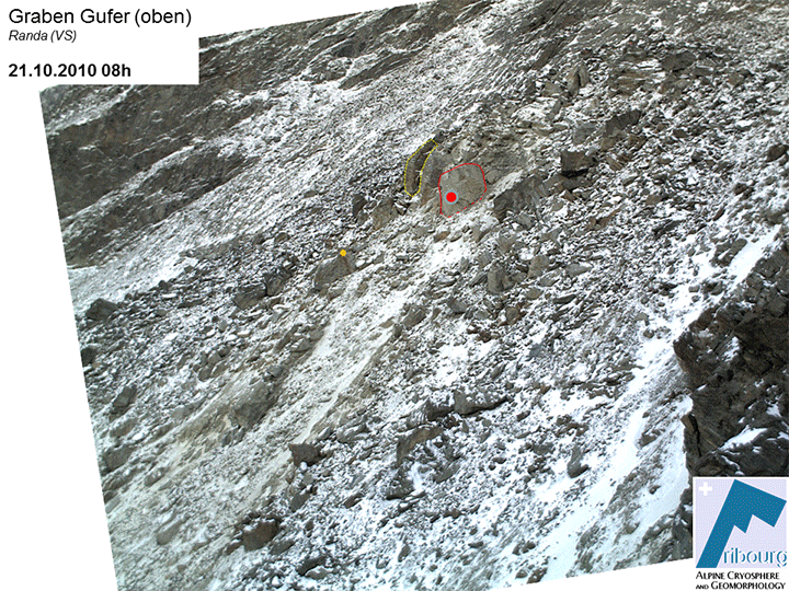
Timelapse based on selected webcam images: southwestern front of the landslide and subjacent slope movement (2010-2017).
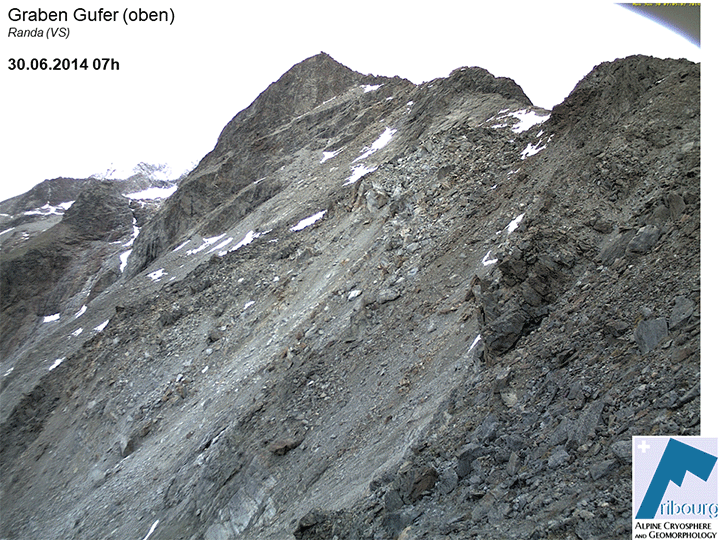
Timelapse based on selected webcam images: southwestern front of the landslide and subjacent slope movement (since 2018).
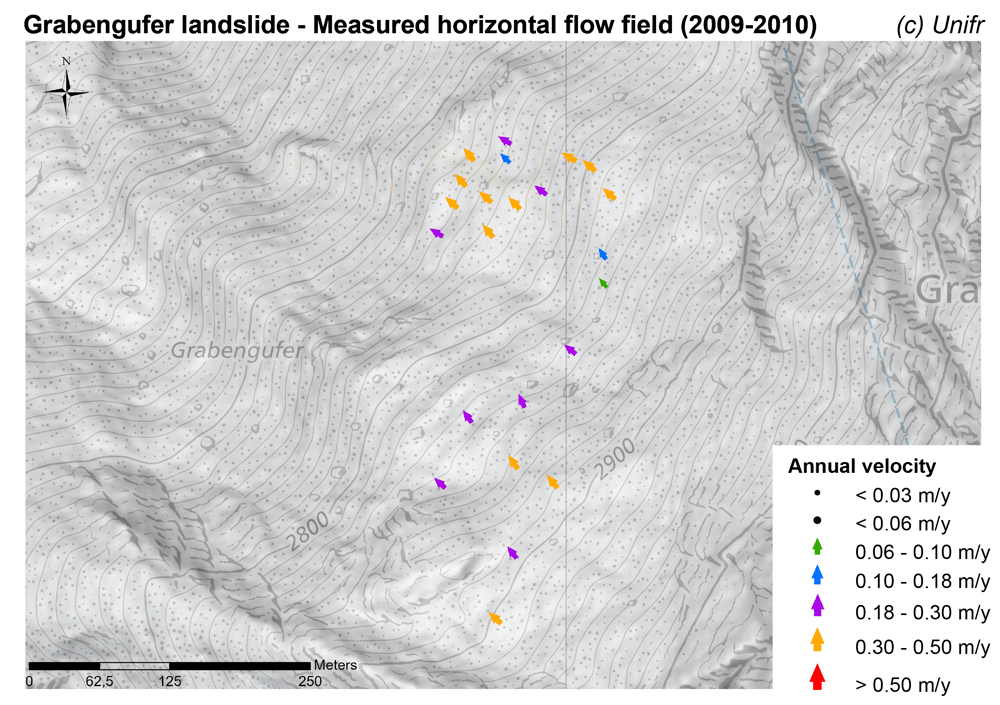
Measured horizontal flow field (mean annual velocity).
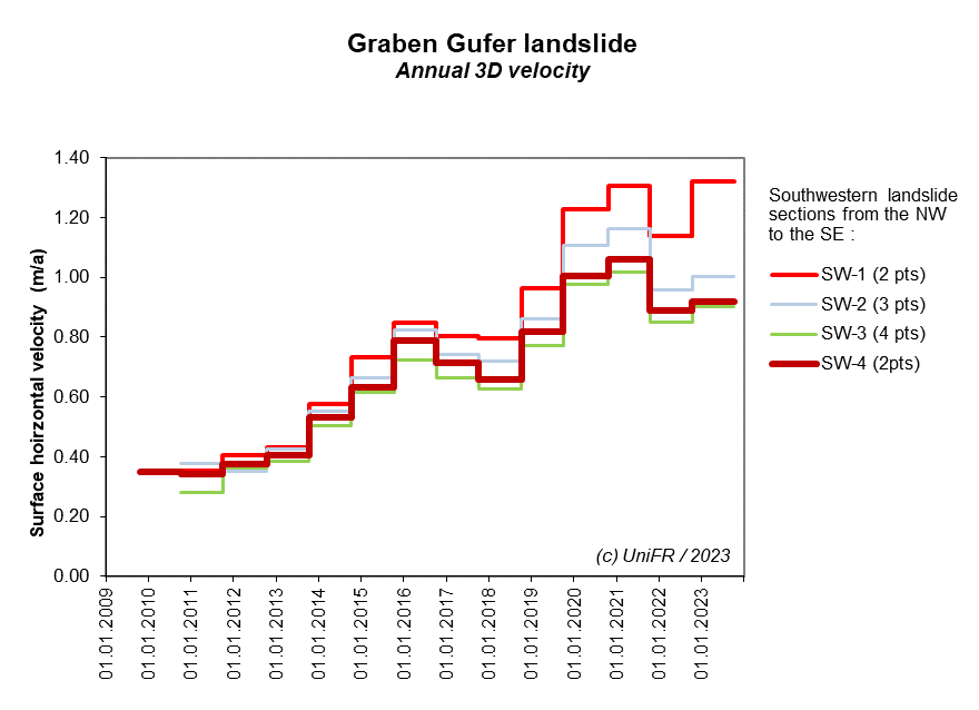
Seasonal horizontal surface velocity of the southwestern part of the landslide. Mean of a set of selected points.
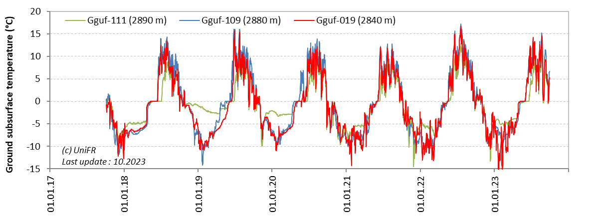
Mean daily ground surface temperature (GST) in selected measurement locations on the landslide.
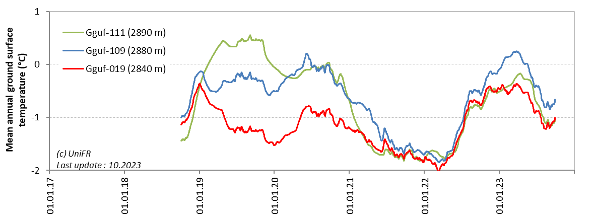
Mean annual ground surface temperature (MAGST) in selected measurement locations on the landslide.
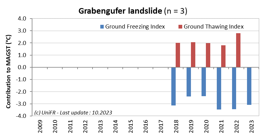
Contribution of the Ground Freezing and Ground Thawing Indexes to the mean annual ground surface temperature (MAGST) on a set of selected locations (n) on the landslide. Or : how cold was the winter and how warm was the summer at the ground surface?
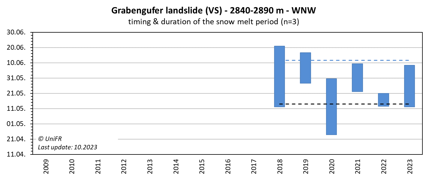
Mean annual dates of the start and end of the snowmelt period (zero curtain phase) on a set of selected locations (n) on the landslide.
More
-
Collaboration
Gemeinde Randa
Kanton Wallis – Dienststelle für Wald, Flussbau und Landschaft (DWFL)
Aufdenblatten GEOMATIK AG
ID electronic SA
Further measurements are undertaken by the Federal Office for the Environment and ETH Zurich.
-
Publications
Kenner R., Bühler Y., Delaloye R., Ginzler C. and Phillips M. (2014). Monitoring of high alpine mass movements combining laser scanning with digital airborne photogrammetry. Geomorphology, vol. 206, p. 492-504. DOI: 10.1016/j.geomorph.2013.10.020
Delaloye, R., Morard, S., Barboux, C., Abbet, D., Gruber, V., Riedo, M. and Gachet, S. (2013). Rapidly moving rock glaciers in Mattertal. In: Graf, C. (ed.) Mattertal – ein Tal in Bewegung. Publikation zur Jahrestagung der Schweizerischen Geomorphologischen Gesellschaft 29. Juni – 1. Juli 2011, St. Niklaus. Birmensdorf, Eidg. Forschungsanstalt WSL. 21-30. (pdf)
PERMOS (2013). Permafrost in Switzerland 2008/2009 and 2009/2010. Noetzli, J. (ed.), Glaciological Report (Permafrost) No. 10/11 of the Cryospheric Commission of the Swiss Academy of Sciences, 80 pp. (pdf)