LÄNGENSCHNEE (VS)
Landslide (sagging)
Altitude: 2560-2660 m - Massif: Valais Alps (Mischabel) - Commune : St-Niklaus (VS)
The motion of the Längenschnee landslide (sagging), located at an altitude of about 2600 m a.s.l. on the western slope of the Gugla summit, is regularly surveyed by means of DGNSS since 2007. The surveyed marks are concentrated in a central part of the landslide (which is not the fastest zone) and also, since 2016, along the Europaweg path. Permafrost is likely to occur in a large part of the moving mass.
-
Measurements and observations
Geodetic (GNSS)
-
Figures
Current image of the front of the moving mass and its surroundings.
Current image of the front of the moving mass.
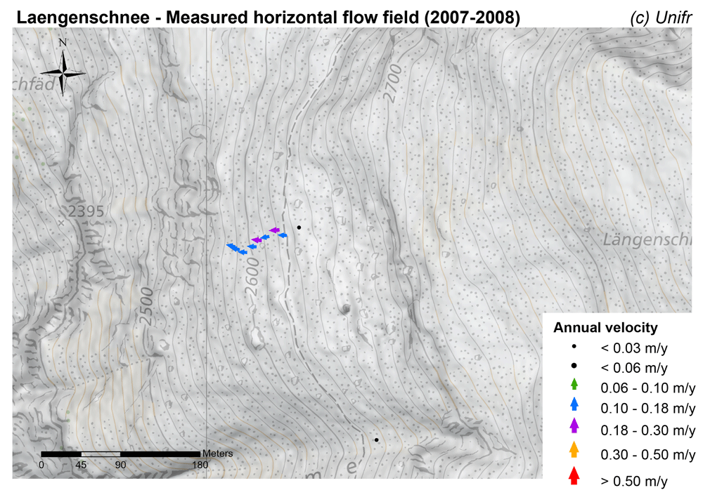
Measured horizontal flow field (annual velocity).
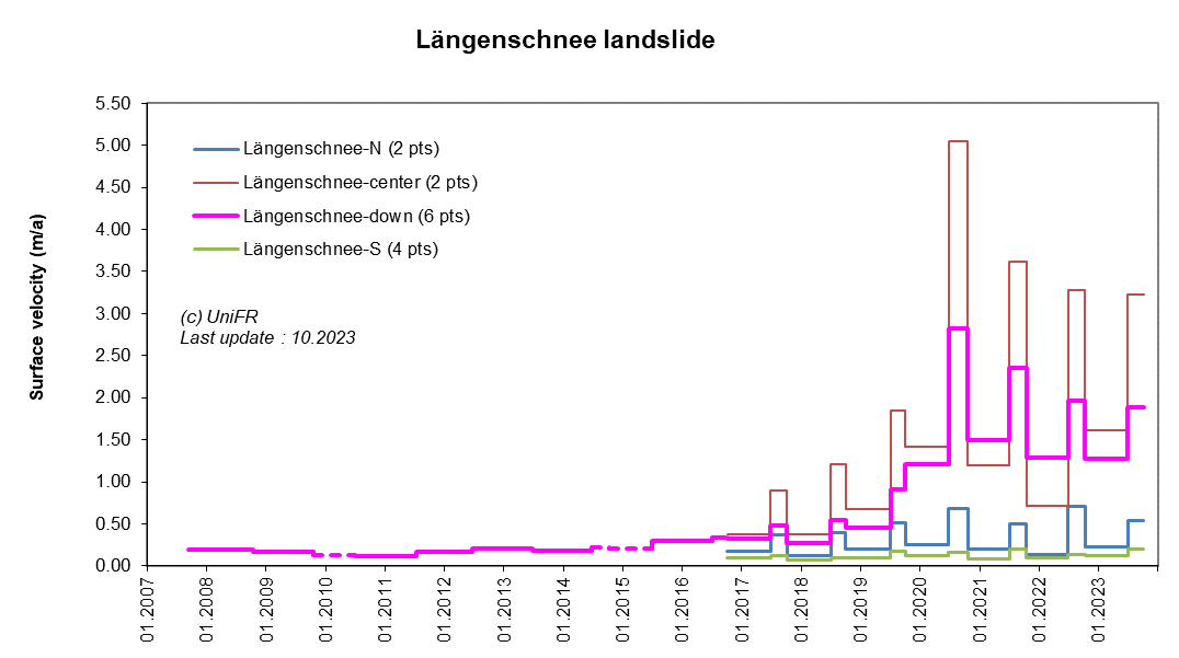
Annual surface 3D velocity. Mean of a set of points selected in various parts of the landslide.
-
Collaboration
Gemeinde St-Niklaus
Kanton Wallis – Dienststelle für Wald, Flussbau und Landschaft (DWFL)
Further measurements are undertaken by the Federal Office for the Environment and ETH Zurich.
-
Publications