KLEIN FURKAHORN (UR)
Active rock glaciers, inactive rock glacier, glacier forefield
Altitude: 2540-2800 m - Massif: Uri Alps - Commune: Realp (UR)
Two active rock glaciers develop in a small valley southeast of Chli Furkahorn. Their motion rate is low (about 0.1 m/y). Downward in the valley succeeds an inactive rock glacier (absence of significant motion), whose terminal tongue was overrun by the Sidelen glacier during the Little Ice Age. Partly still nowadays frozen, formerly overridden sediments creep downwards within the morainic system. In situ surveying has been performed regularly since 2009.
-
Measurements and observations
Thermal (ground surface temperature : GST)
Geodetic (GNSS) -
Figures
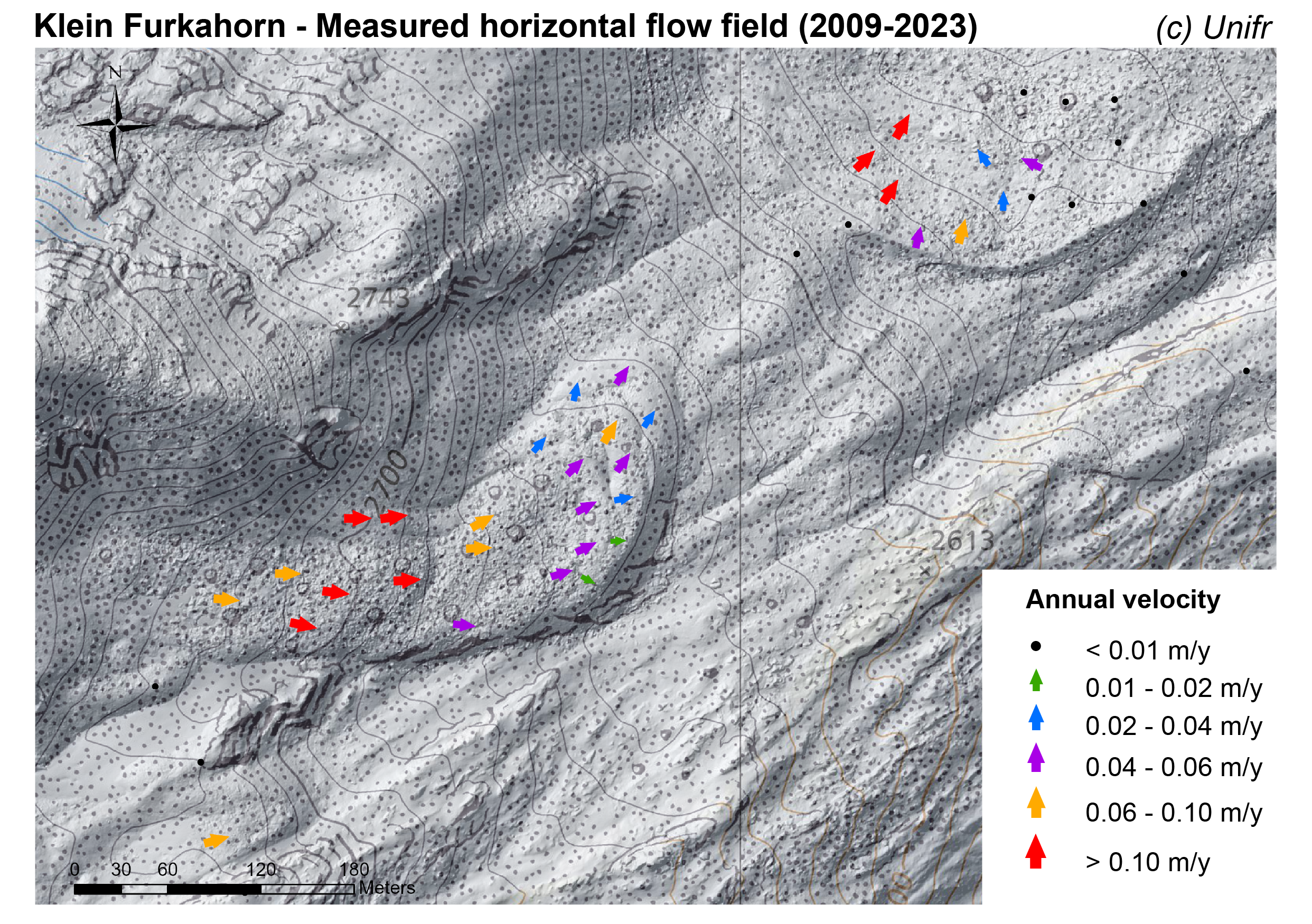
Measured horizontal flow field (annual velocity)
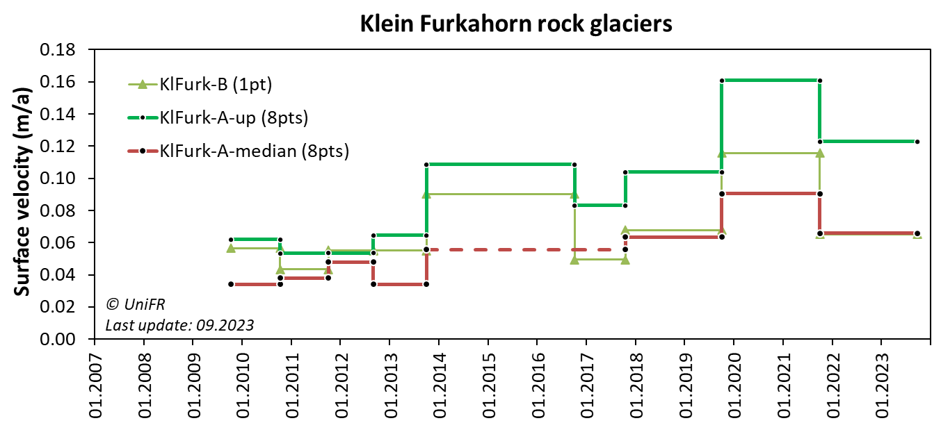
Annual surface 3D velocity in the uppermost and central areas of the rock glacier. Mean of selected sets of points.
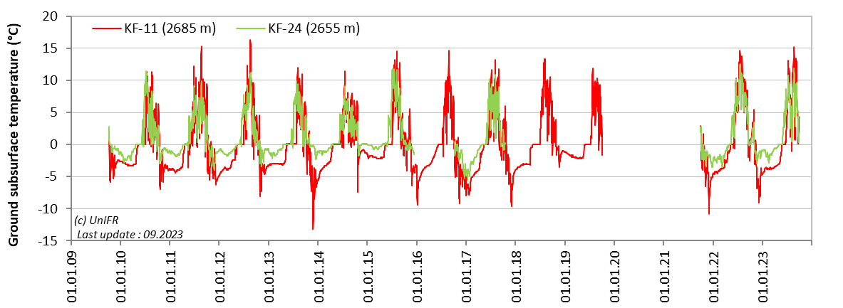
Daily ground surface temperature (GST) in selected measurement locations on the rock glacier.
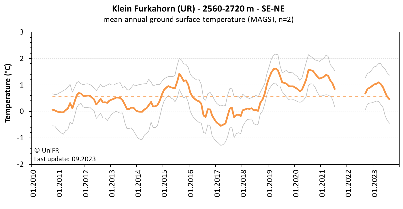
Mean annual ground surface temperature. The orange curve represents the mean temperature of the n sensors installed on the site (grey curves). The orange dotted line is the mean temperature observed since the beginning of the time series.
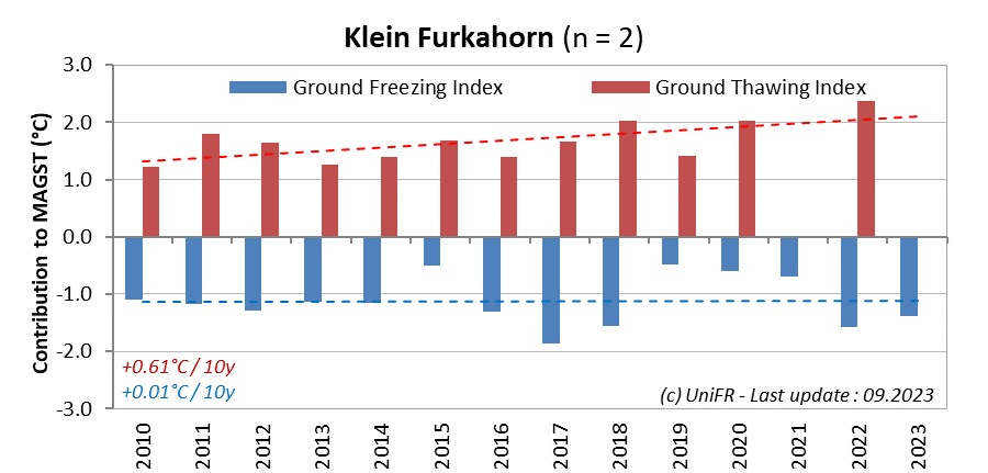
Contribution of the annual Ground Freezing (sum of all daily mean values < 0°C) and Ground Thawing (>0°C) Indexes to the mean annual ground surface temperature (MAGST) on a set of selected locations (n) on the rock glacier with indication of the respective trend since the beginning of the time series. Or : how cold was the winter and how warm was the summer at the surface of the rock glacier ?
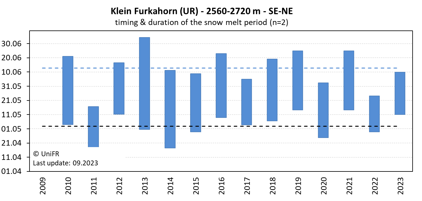
Mean annual dates of the start and end of the snowmelt period (zero curtain phase) on a set of selected locations (n) on the rock glacier
-
Collaboration
-
Publications