BREITHORN (VS)
Landslide/sagging
Elevation: 2620-3150m - Massif: Valais Alps (Mischabel) - Commune: St-Niklaus (VS)
The entire Breithorn south-west facing slope is moving downwards at a significant rate (0.1 to 0.5 m/y) due to the occurrence of a deep-seated landslide. The motion rate is regularly surveyed by DGNSS since 2008. Permafrost is widespread in the upper and northern parts of the landslide.
-
Measurements and observations
Geodetic (GNSS)
Remote Sensing (aerial image)Thermal (Ground surface temperature – GST)
-
Figures
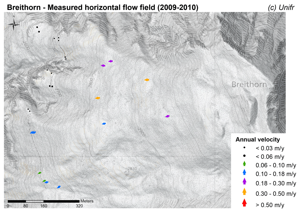
Measured horizontal flow field (annual velocity).
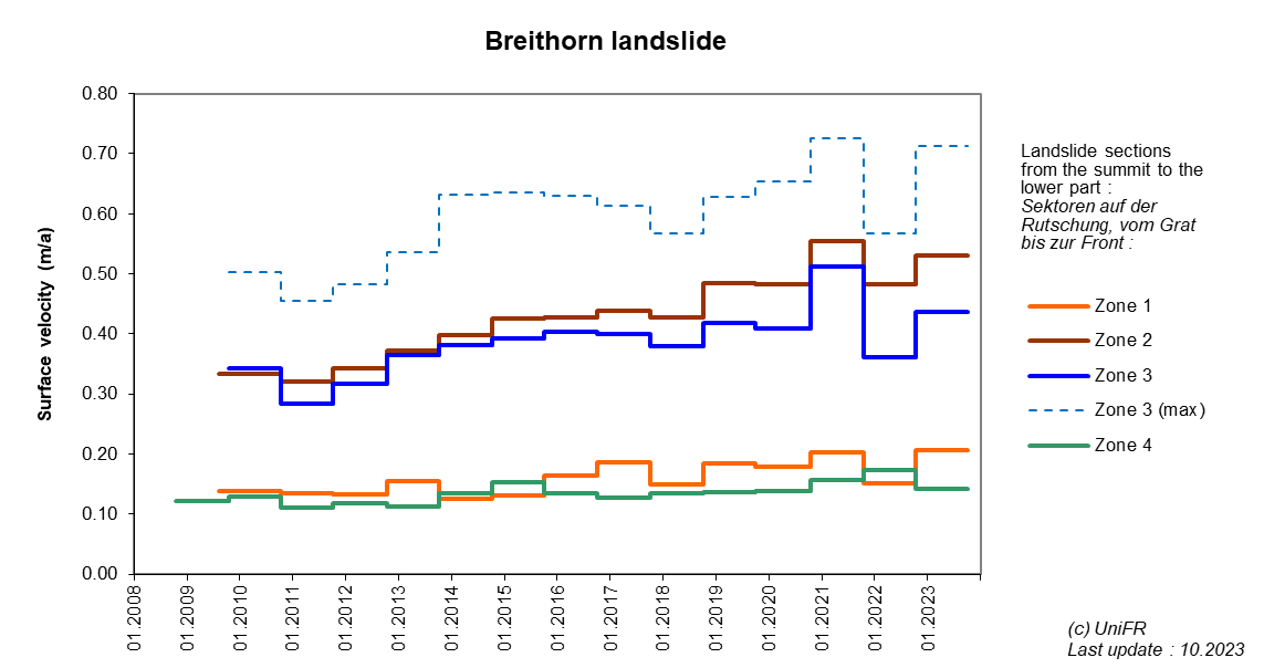
Annual surface velocity. Mean of a set of points selected in various parts of the landslide.
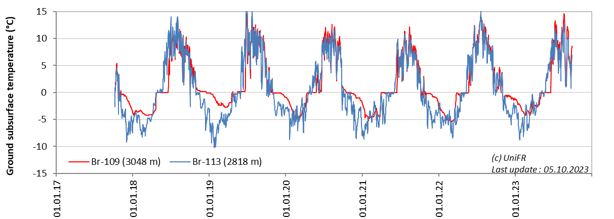
Daily ground surface temperature (GST) at selected measurement locations on the landslide.
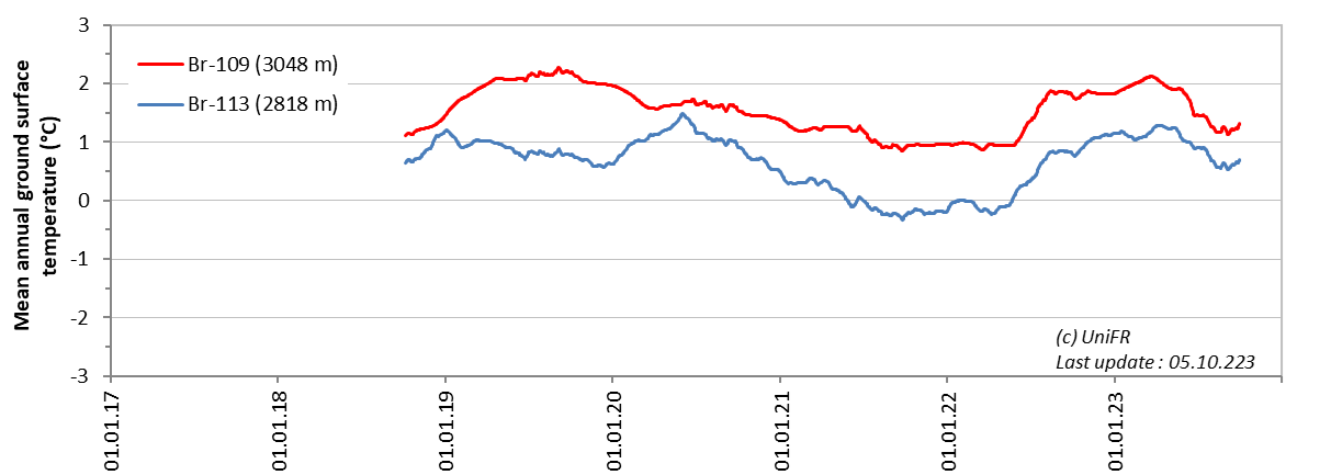
Mean annual ground surface temperature (MAGST) at selected measurement locations on the landslide.
-
Collaboration
Gemeinde St-Niklaus
Kanton Wallis – Dienststelle für Wald, Flussbau und Landschaft (DWFL)
Further measurements are undertaken by the Federal Office for the Environment and ETH Zurich.
-
Publications