Geomorphology is the study of landforms, their genesis and evolution. Understanding the processes leading to the development of the present relief and predicting future changes are the major aims of this discipline. These goals are achieved by combining field investigation, monitoring, remote sensing, laboratory analysis and numerical modelling. The geomorphology research group at the University of Fribourg is active on many sites centered within the Swiss Alps, but also in the Prealps and the Jura mountains. Assessing the dynamics and the evolution of mountain slopes retains its main attention, especially in periglacial regions (permafrost).
-
Geomorphological mapping
The purpose of geomorphological mapping is to provide information on the geometry of landform shapes, the nature and structure of shallow formations, the activity of processes and, as much as possible, the relative age of landforms. It is an indispensable preliminary tool to correctly localize the sites on which more expensive and more demanding measurements could be realized.
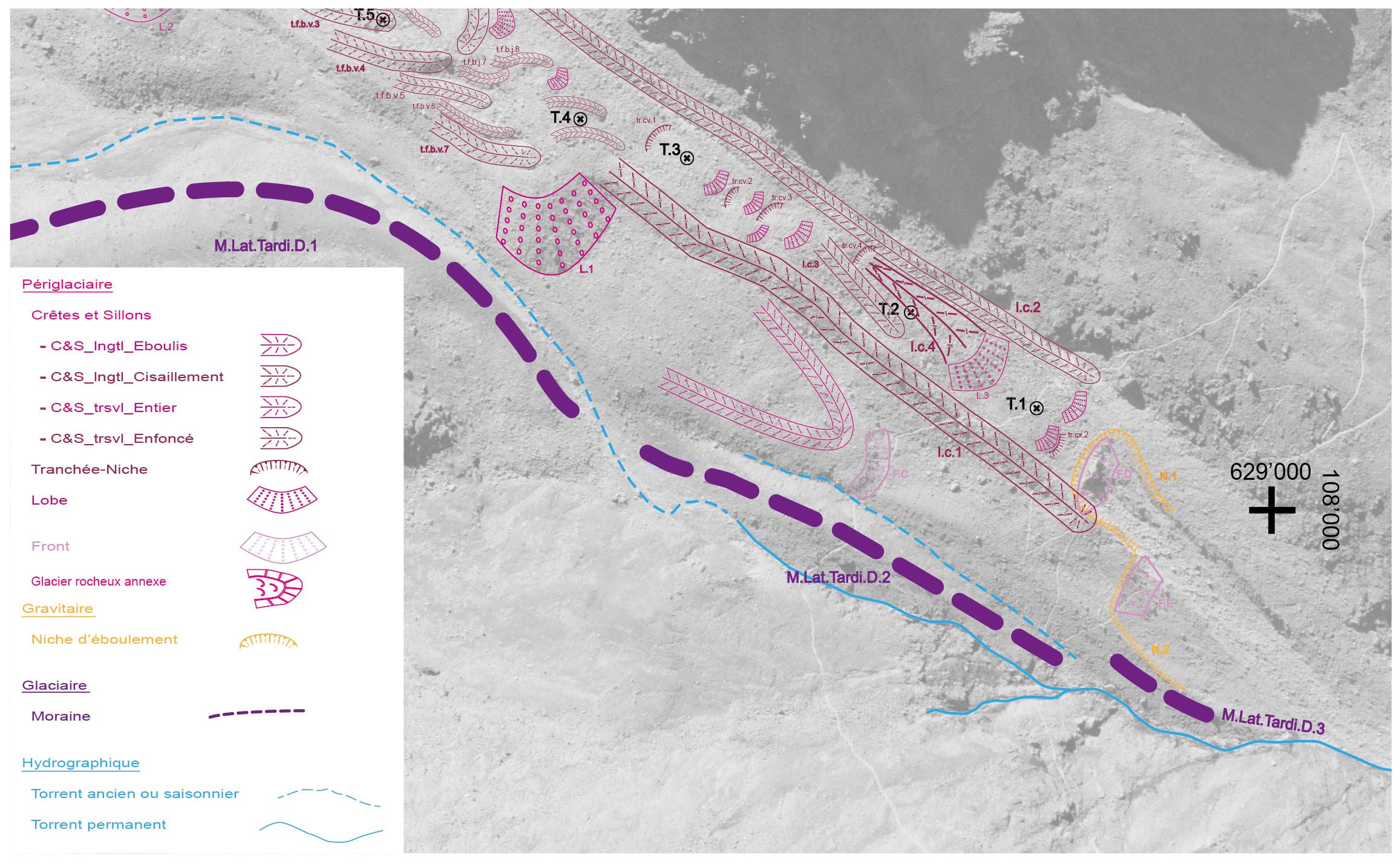
Extract from a geomorphological map of the Dirru rock glacier (V. Gruber, 2010) -
Geodesic measurements
Geodetic measurements allow to obtain the precise location of marked points on the ground or permanent installations. By repeating the positioning operation in time, this method makes it possible to determine the velocity of ground surface movements.
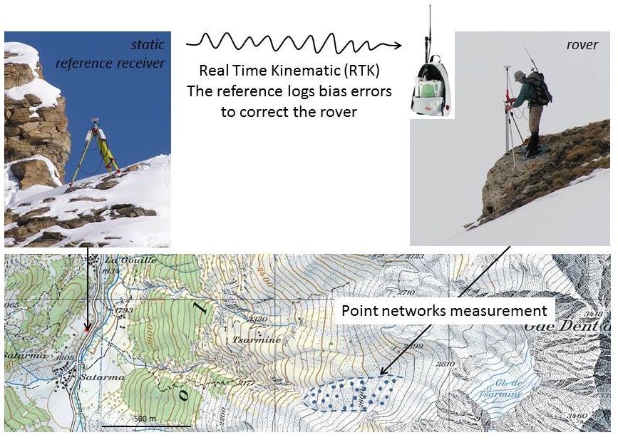
Networks of measuring points on the ground
The repeated measurement of points marked on the ground using a differential GPS (GNSS) makes it possible to determine the field vectors of surface displacement on the ground. This method is mainly used for monitoring rock glaciers and landslides kinematics. Measurements are done regularly, usually one to several times a year, over a network of up to more than 100 points. The longest continuous observation series carried out by the Geography Unit dates back to 2001 (rock glaciers of Becs-de-Bosson and Aget).
Lambiel and Delaloye, 2004. Contribution of Real-time Kinematic GPS in the Study of Creeping Mountain Permafrost: Examples from the Western Swiss Alps. (pdf)
Measurements of displacements using differential GPS. Permanent stations
Several sites are equipped with permanent GPS stations. Each of them allows real-time measurement of the position of a single point. These measurements are carried out in collaboration with Geosat SA
.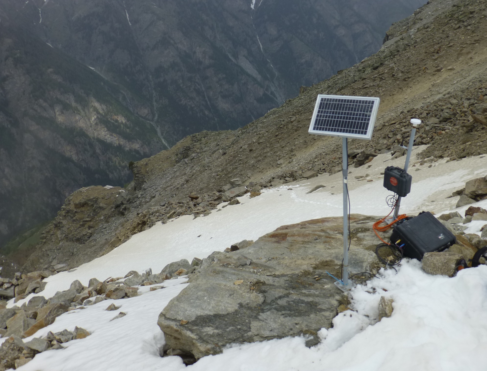
Measurement of displacements using a permanent station. -
Geophysical measurements
The various materials constituting the subsurface have specific physical properties (resistance to electric current, speed of propagation of seismic waves, ...). The geophysical methods allow to acquire indirect information on the nature of the subsoil (presence of ice, thickness of the underlying materials, etc.). Several study sites are equipped with fixed geophysical profiles, along which measurements can be repeated periodically, allowing the observation of the temporal evolution of particular parameters (temperature, water content, etc.). In the alpine periglacial context, geoelectrics, seismic refraction and ground penetrating radar are currently the most appropriate techniques.
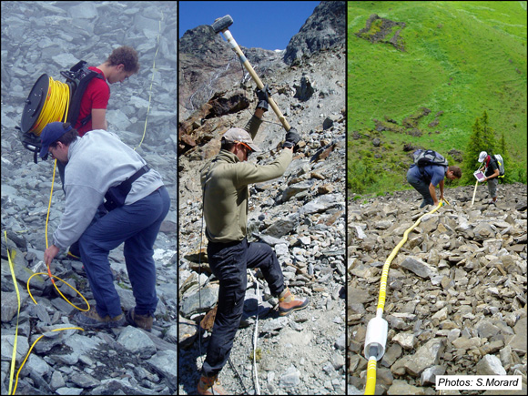
Application of geophysical methods in the alpine environment: installation of a geoelectric profile (left), seismic refraction with hammer (center) and georadar (right) 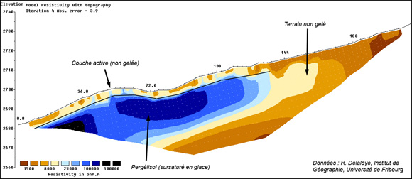
Example of geophysical profile (here geoelectric) carried out on a rock glacier. The blue color (ground resistant to electric current) indicates the presence of ice-rich permafrost; brown colors unfrozen terrain (conductor) -
Remote sensing
Remote sensing involves the acquisition of remote information (e.g. from an airplane, a satellite, etc.) by means of various instruments (radar, lasers, cameras ...). They allow the documentation of the ground condition by giving information on the ground cover as well as its precise topography at a given moment. In periglacial environment, the repetition of acquisitions offers the possibility in particular to detect, determine and follow surface movements (rock glaciers, landslides, ...).
Satellite radar interferometry (InSAR)
Satellite radar interferometry is used to regionaly map periglacial movement patterns and to determine their kinematic characteristics.
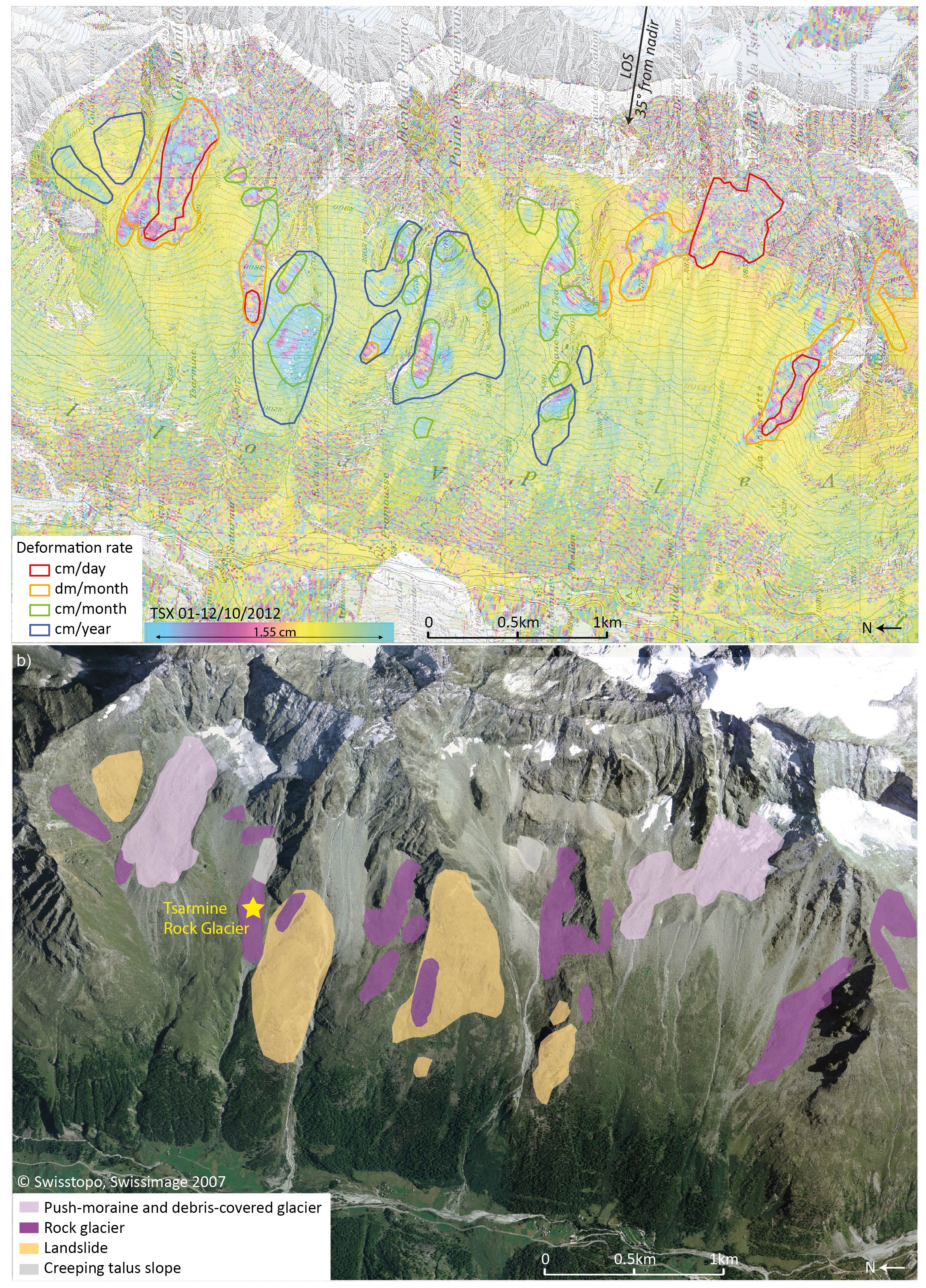
Inventory of mass movements in the periglacial zone. Lidar
Terrestrial lidar allows to produce very precise digital elevation models of the ground surface. By repeating the operation after a certain time, sediment transfer phenomena can be identified and quantified (e.g. erosion at the front of a rock glacier).
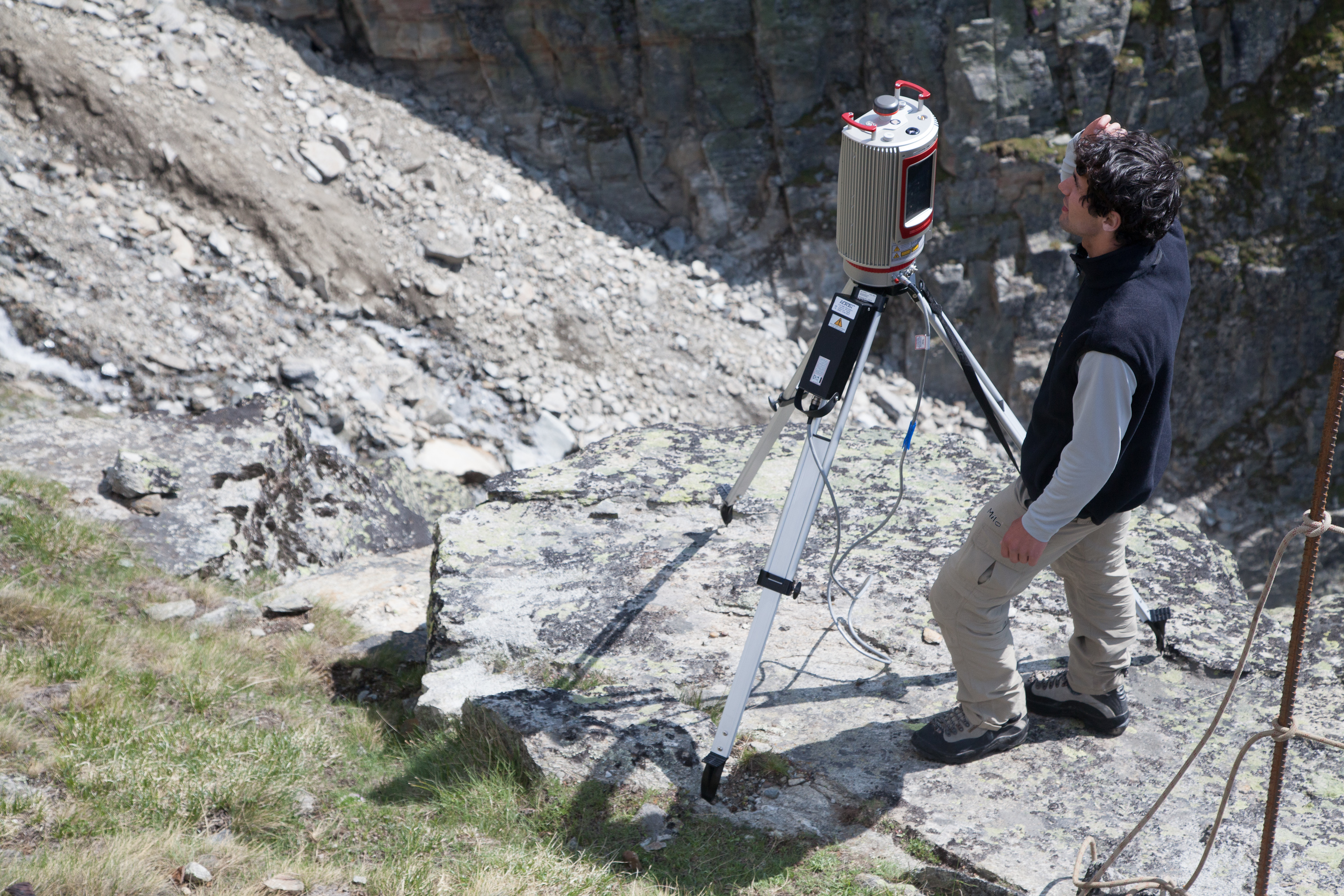
Lidar measurments -
Thermal measurements
In the periglacial environment, many phenomena are related to the thermal state of the ground, whether the near-surface (freeze-thaw cycles) or at greater depth (permafrost), as well as its variations. The mapping of the ground thermal state in winter, under snow cover, is carried out by BTS measurements. The surface thermal regime can be documented by autonomous temperature sensors. The continuous measurement of the subsoil materials temperature can be carried out in boreholes.
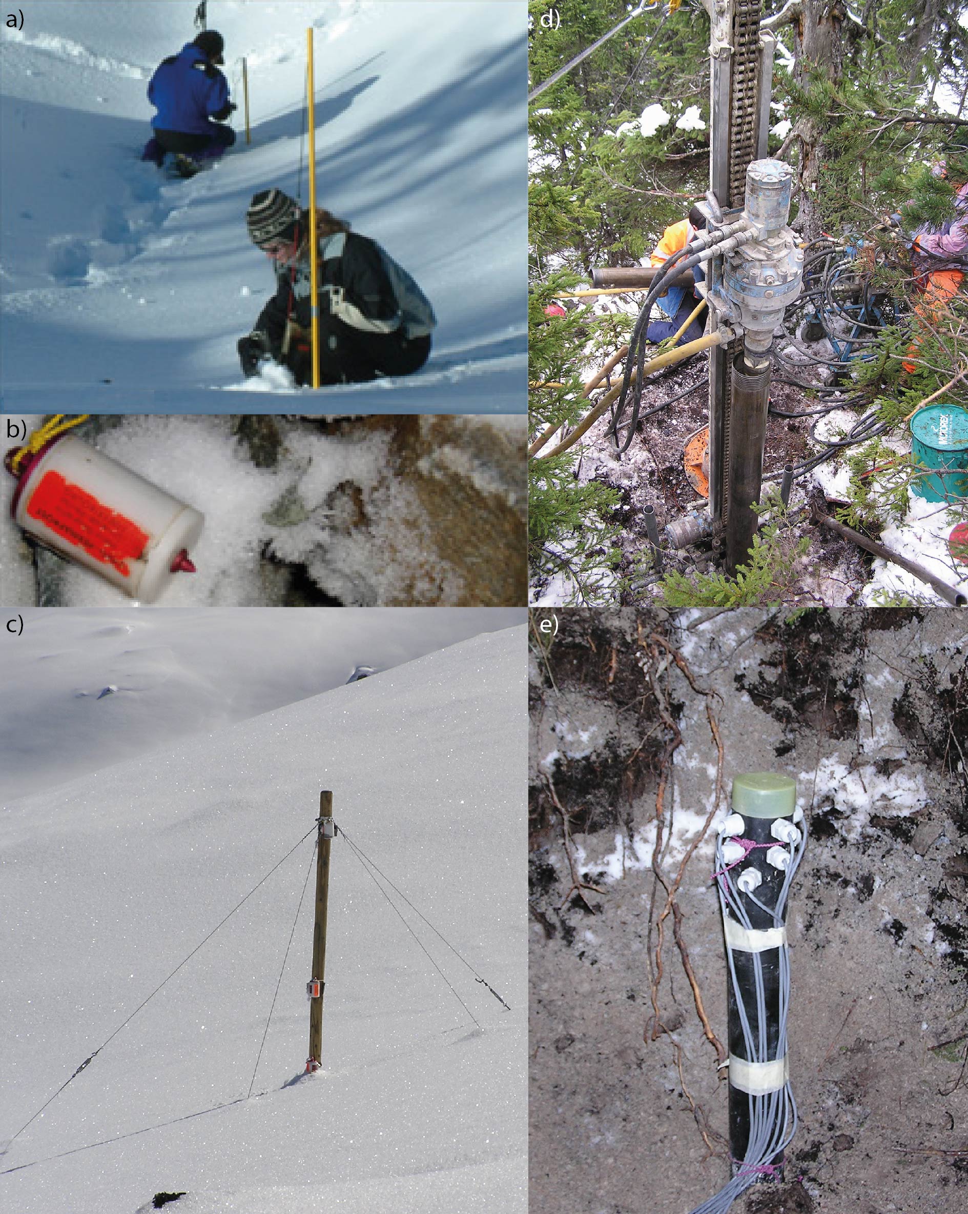
Thermal measurements. a) Use of BTS probes. b) Autonomous thermal sensor. c) Snow Mast. d) Installation of a borehole. e) Drilling equipment with thermal sensors. -
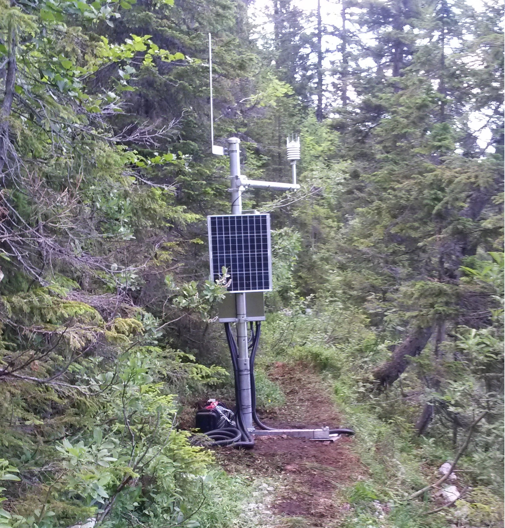
Weather stations
Meteorological parameters (air temperature, precipitation, radiation, ...) play a fundamental role in the triggering and the dynamics of many geomorphological processes. In addition to the data from Météosuisse stations and from the Institute for Snow and Avalanche Studies (SLF), the Geography Unit has its own stations at several sites.
Data record from a weather station.