GRABENGUFER (VS)
Active rock glacier
Elevation: 2440-2700m - Massif: Valais Alps (Mischabel) - Commune: Randa (VS)
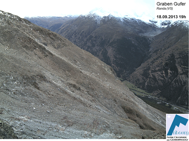
The Grabengufer rock glacier, located on the orographic right side of the Mattertal, is one of five rock glaciers that were detected as destabilized in the mid-2000s using satellite interferometry (InSAR). A first destabilization phase already happened around 1940. A fast-flowing rock glacier formed. Protective walls were built in Grüengarten-Höüschbiel to derive the consecutive debris flows back towards the Dorfbach gully. This first "crisis" probably lasted only for a few years. The transverse fissures that had formed in the middle of the rock glacier were still visible until 2005. A recent extraordinary "crisis" began during the 1980’s in the upper root zone of the rock glacier. Within 25 years, a compression wave spread throughout the whole length of the rock glacier. While the central area of the rock glacier has accelerated since 2000, the frontal part strongly started to accelerate only since 2005. The unstable frontal part has finally pulled down the whole rock glacier. Peak velocities (up to > 100 m/y) were measured between July 2009 and February 2010. Thereafter, the movements have greatly decreased. In 2013, the movements at the front remained abnormally high (> 25 m/y), while they reached almost usual velocities in the middle of the rock glacier (1.3 m/y). The first displacement measurements (DGPS) were started there in 2009.
-
Measurements and observations
Geodetic (GNSS, permanent GPS, reflectors)
Geophysics (geoelectric, refraction seismic, georadar)
Remote Sensing (webcam, aerial image) -
Figures
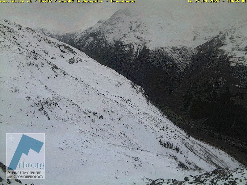
Current image of the rock glacier.
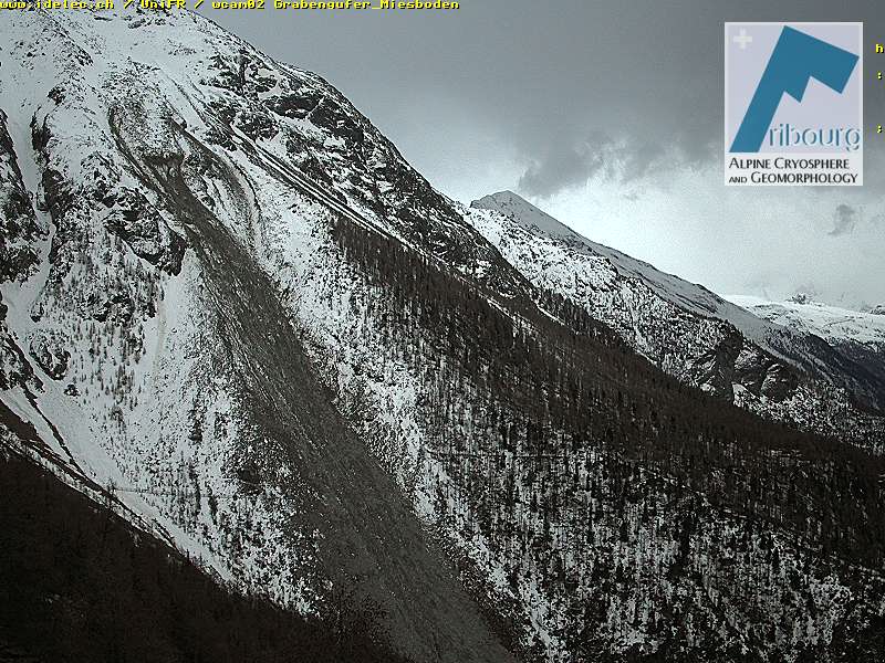
Current image of the rock glacier (up) and the downstream gully.
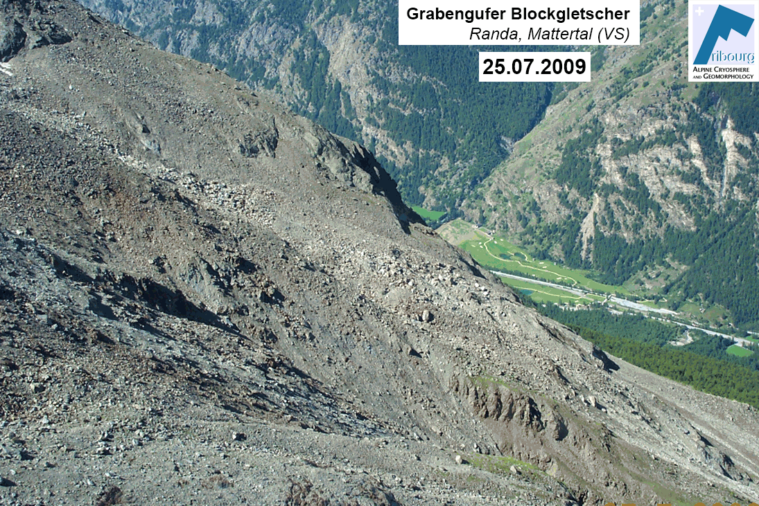
Timelapse based on selected images taken by an automatic photo device (2009-2013).
Timelapse based on selected webcam images since 2013.
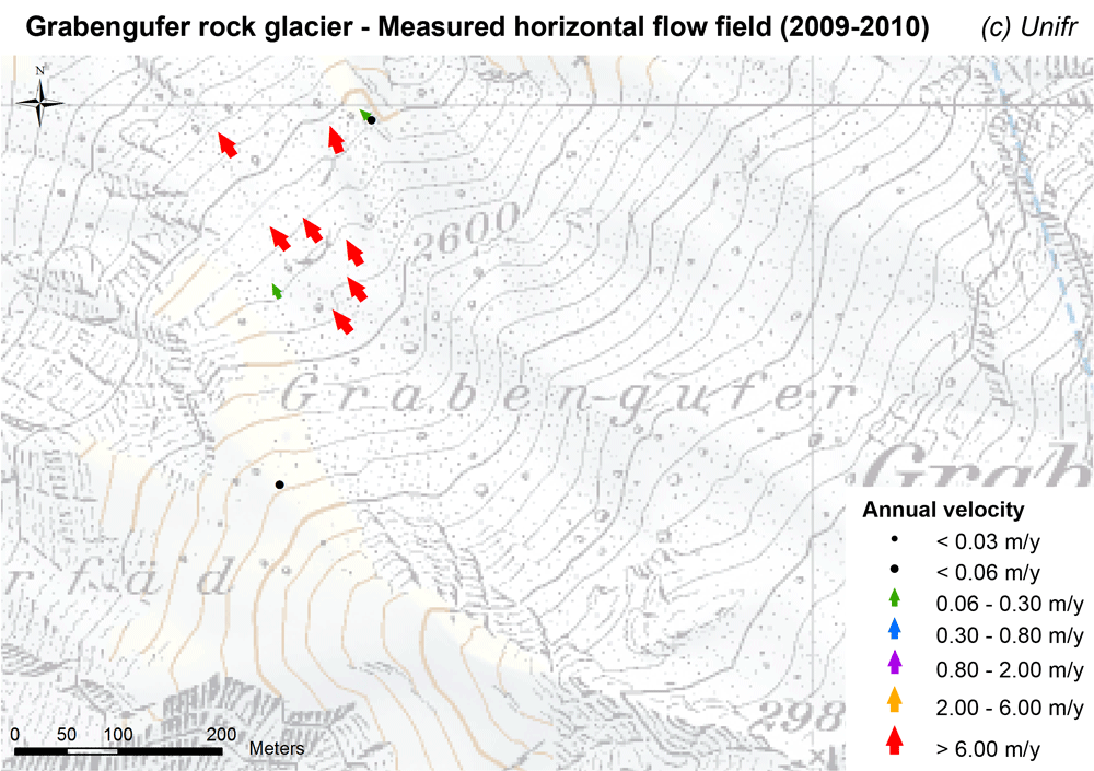
Measured horizontal flow field (mean annual velocity).
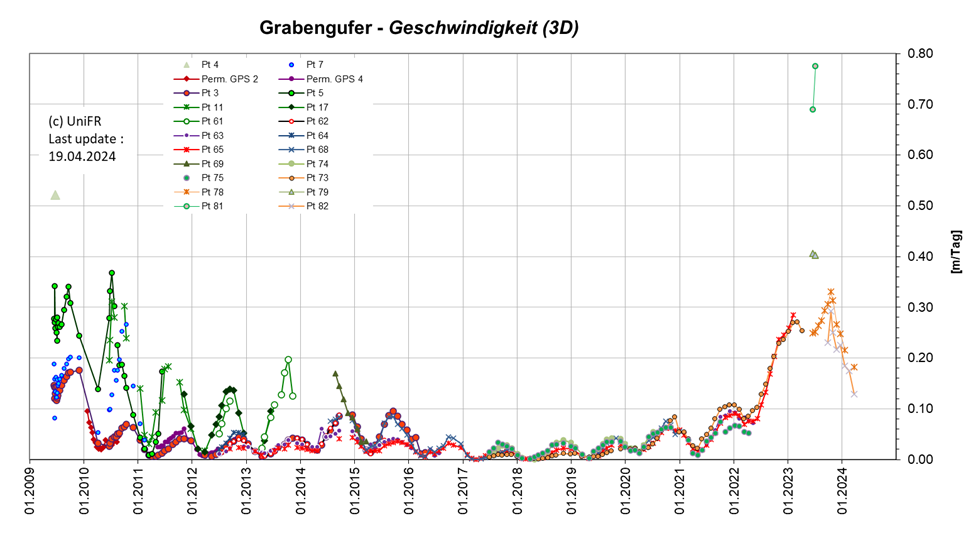
Annual 3D surface velocity (in m/day). Measurement points on the main terminal tongue are displayed in green, upstream of the main terminal tongue (northern part of the rock glacier) in red, upstream of the southern front in blue/violet.
-
Collaboration
Gemeinde Randa
Kanton Wallis – Dienststelle für Wald, Flussbau und Landschaft (DWFL)
Aufdenblatten GEOMATIK AG
ID eletronic SA
-
Publications
Delaloye, R. & Staub., B. (2016). Seasonal variations of rock glacier creep: time series observations from the Western Swiss Alps. In: Günther, F. and Morgenstern, A. (Eds.) (2016): XI. International Conference On Permafrost – Book of Abstracts, 20 – 24 June 2016, Potsdam, Germany. Bibliothek Wissenschaftspark Albert Einstein. 22-23. (pdf)
Kenner R., Bühler Y., Delaloye R., Ginzler C. and Phillips M. (2014). Monitoring of high alpine mass movements combining laser scanning with digital airborne photogrammetry. Geomorphology, vol. 206, p. 492-504. DOI: 10.1016/j.geomorph.2013.10.020
Delaloye, R., Morard, S., Barboux, C., Abbet, D., Gruber, V., Riedo, M. and Gachet, S. (2013). Rapidly moving rock glaciers in Mattertal. In: Graf, C. (ed.) Mattertal – ein Tal in Bewegung. Publikation zur Jahrestagung der Schweizerischen Geomorphologischen Gesellschaft 29. Juni – 1. Juli 2011, St. Niklaus. Birmensdorf, Eidg. Forschungsanstalt WSL. 21-30. (pdf)
PERMOS (2013). Permafrost in Switzerland 2008/2009 and 2009/2010. Noetzli, J. (ed.), Glaciological Report (Permafrost) No. 10/11 of the Cryospheric Commission of the Swiss Academy of Sciences, 80 pp. (pdf)